Frost forms when a surface, such as a leaf, a car roof or a blade of grass, cools to 32°F (0°C) or below and the moisture in the air touching it turns straight to ice. The catch for gardeners is that the low in your forecast is not the temperature of your plants. Forecast and official air temperatures are measured about 2 meters (5 to 6.5 feet) above the ground, and on a clear, calm night the air at leaf level can be several degrees colder. That is why frost can whiten a lawn on a night when the forecast low was 34°F or 36°F. This page is about frost on a given night; for the calendar dates of your last and first frost, see our comparison of Farmers’ Almanac and NOAA frost dates.
What Temperature Is Frost? The Quick Answer
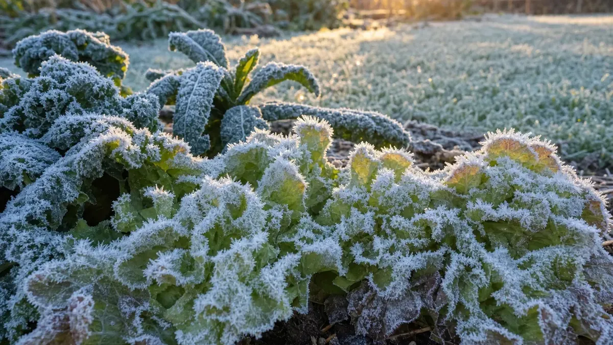
The National Weather Service glossary defines frost as thin ice crystals that form on the ground or other surfaces, in the shape of scales, needles, feathers or fans, when surface temperatures fall below freezing. It is the frozen cousin of dew. So when people ask what temp is frost, the honest answer has two parts: 32°F at the surface, and anything from the low 30s up to about 36°F in the forecast, depending on the night.
Why Frost Forms When the Forecast Says 35°F
Official thermometers sit in shelters well above the ground. NWS Tallahassee gives the standard height as 6.56 feet (2 meters); NWS Charleston, West Virginia, describes it as about five feet. Your tomato plants live much lower than that.
After sunset, the ground and everything on it lose heat by radiating it toward the sky. The soil surface, grass and leaves cool fastest, and they chill the thin layer of air right above them. On a still night that cold layer stays put, so, as NWS Charleston puts it, near-surface air can be several degrees colder than the reading at a standard observation site. NWS Tallahassee explains the same thing: heat radiates away from the ground, leaving the air very close to the ground the coldest, which is how frost forms at ground level while the official air temperature stays between 32°F and 36°F.
The frost temperature that matters to a plant is the temperature of its own leaves. A thermometer on a fence post at eye level will read warmer than the lettuce bed on those nights, so use it as a guide rather than a guarantee.
Frost Advisory vs. Freeze Warning: What the NWS Criteria Mean
The NWS issues frost and freeze alerts during the growing season to warn about damage to plants and crops. The exact numbers are set by each local forecast office, so they vary a little by region. Here is how three offices describe them on their own pages:
| Alert | NWS Tallahassee | NWS Charleston, WV | NWS Omaha |
|---|---|---|---|
| Frost Advisory | Lows of 32-36°F with calm winds and humidity near 100% | Lows of 33-36°F with light winds and clear skies | Patchy frost possible at 38-42°F, areas of frost at 33-37°F |
| Freeze Warning | 32°F or lower for at least 2 hours | Lows of 29-32°F | Air temperature of 32°F or lower |
| Hard Freeze | 25°F or lower (varies by office) | 28°F or lower for more than an hour | 28°F or lower for at least a few hours |
The pattern is the same everywhere: a Frost Advisory means the air probably stays just above freezing but frost is likely on the ground and on plants, and a Freeze Warning means the air itself drops to 32°F or below. NWS Charleston notes that a freeze can cause significant damage to many unprotected sensitive plants, especially if temperatures stay at or below freezing for several hours, and that a hard freeze destroys most sensitive plants and can damage outdoor plumbing and sprinkler lines.
Light, Moderate and Severe Freezes: Which Crops Each One Damages
Climatologists and extension services group freezes by how cold the air gets. The Western Regional Climate Center and University of Georgia Extension use the same three categories:
| Category | Air temperature | What it does | Garden crops affected |
|---|---|---|---|
| Light freeze | 29-32°F | Tender plants killed, little damage to other vegetation | Tomatoes, peppers, eggplant, snap and lima beans, cucumbers, squash, pumpkins, melons, sweet corn, okra and sweet potatoes |
| Moderate freeze | 25-28°F | Widely destructive to most vegetation, heavy damage to fruit blossoms and to tender and semi-hardy plants | Frost-tolerant crops such as broccoli, cabbage, cauliflower, carrots, beets, chard and Brussels sprouts start to take damage; very hardy crops usually come through |
| Severe (hard) freeze | 24°F and colder | Heavy damage to most plants; the ground freezes solid | Even hardy crops such as kale, collards, spinach and turnips can be hurt, depending on how long it lasts |
The crop lists come from University of Nebraska-Lincoln Extension in Lancaster County, which sorts vegetables into three groups: tender crops killed by a light frost of 28-32°F, frost-tolerant crops that survive a light frost, and very hardy crops, including kale, collards, spinach and turnips, that tolerate a hard frost below 28°F. Duration matters as much as the number. An hour at 30°F just before sunrise does far less harm than six hours at 30°F.
Clear, Calm Nights vs. Cloudy or Windy Nights
Two nights with the same forecast low can end very differently. NWS Omaha lists the ingredients for frost: clear skies, which let the most heat escape from the ground, and calm to light winds, which let a thin layer of very cold air settle at the surface. NWS Charleston adds that frost is not guaranteed if the air is very dry, if enough cloud cover is in place, or if winds are about 6 mph or more.
Clouds act like a lid. An NWS training page on dew and frost explains that cloudy skies absorb heat radiating from the ground and send it back down, so the surface cools much less. Wind stirs warmer air from a few feet up down to the ground and keeps that cold layer from forming. A breezy, overcast night at 33°F often brings no frost at all, while a clear, still night at 35°F can bring a heavy one.
Where dew point fits in
The dew point is the temperature at which the air becomes saturated and its water vapor starts to condense. When a leaf cools to the dew point, moisture collects on it. The same NWS training page describes two ways frost forms. If the dew point (called the frost point when it is below freezing) is under 32°F, vapor turns straight into ice crystals on surfaces that cool that far: classic white hoar frost. If the dew point is above freezing, dew forms first and then freezes once the surface drops to 32°F, giving a glaze of frozen dew. Very dry air works the other way: the dew point sits far below the air temperature, so plants can freeze without visible frost. This kind of freeze still kills tender plants even though nothing turns white.
A useful habit on a borderline evening: check the forecast low and the dew point together. A small gap between the temperature and the dew point, moist soil, clear skies and little wind all point toward frost by morning.
Low Spots and Frost Pockets
Cold air is denser than warm air, so on a calm night it drains downhill and pools in the lowest ground, the same way water would. NWS Omaha notes that cold air settles in valleys, and NWS Charleston adds that valleys are also sheltered from wind, which makes frost even more likely there. In a backyard, the low corner, the bottom of a slope or a bed hemmed in by a solid fence can frost on nights when the rest of the garden stays clear. NWS Omaha also lists soil moisture, nearness to large bodies of water and how green the vegetation is as factors that change the odds.
If you have a spot like this, plant tender crops on higher ground or closer to the house, where walls hold and release heat, and plan to cover anything in the low spot first.
How to Protect Plants From Frost
When a Frost Advisory or Freeze Warning goes out, a few simple steps go a long way:
- Cover plants before sunset. NWS Charleston recommends covering sensitive plants or moving them indoors before the sun goes down, while the ground still holds the day’s heat.
- Let covers reach the ground. University of Georgia Extension advises that covers reach the soil and be anchored so they trap heat radiating up from the ground. Old sheets and blankets work in a pinch. Plastic can damage leaves it touches, so hold it off the plants with hoops or stakes.
- Use row cover for repeated cold nights. UGA Extension notes that lightweight spunbonded row covers keep plants about 3 to 5 degrees warmer than the outside air.
- Water the soil the day before. NWS Charleston notes that wet soil holds heat better than dry soil, so a watering earlier in the day helps the ground release more warmth overnight.
- Pull covers off in the morning. UNL Extension advises uncovering plants the next morning, especially under plastic, so they do not overheat once the sun is up. UGA suggests removing covers once temperatures climb back above 32°F.
- Harvest before a hard freeze. Pick ripe and nearly ripe tomatoes, peppers, squash and beans before a freeze is forecast. No cover will save tender crops from a severe freeze, and NWS Charleston notes that moving potted plants inside is the main option at that point. If tomatoes are still green, our guide to how to ripen green tomatoes explains how to finish them indoors.
Over the season, the best protection is timing: set out tender transplants after your last spring frost, and have covers ready as your first fall frost date gets close. Our garden winterizing checklist places each fall job on that date.
Free book · 23 pages, PDF
Frost Temperature FAQ
Can it frost at 40 degrees?
It is possible but uncommon. NWS Omaha's frost guidance notes that patchy frost can form with official temperatures of 38-42°F on clear, calm nights, because the ground and leaves can cool well below the air temperature measured about 2 meters up. Exposed, low-lying spots are the most likely to see it.
At what temperature does it frost on a cloudy night?
Usually only when the air itself gets to about 32°F. Clouds send heat back toward the ground, so surfaces stay close to the air temperature instead of cooling several degrees below it. NWS Charleston notes that frost is not guaranteed when enough cloud cover is in place or winds are about 6 mph or more.
What is the difference between frost and a freeze?
Frost is ice crystals forming on surfaces, and it can happen when the official air temperature is a few degrees above 32°F. A freeze means the air temperature itself drops to 32°F or below. A freeze can happen without visible frost if the air is very dry. NWS Charleston describes Frost Advisory nights as bringing minor damage to sensitive plants, while a freeze can cause significant damage to many of them.
What temperature kills tomato plants?
Tomatoes are tender crops. University of Nebraska-Lincoln Extension lists them among the vegetables killed by a light frost of 28-32°F. Leaves can also be damaged by frost on clear nights when the forecast low is in the mid 30s, so cover tomatoes or harvest the ripening fruit whenever frost is in the forecast.
Should I water plants before a frost?
Water the soil, ideally earlier in the day, rather than spraying the leaves in the evening. NWS Charleston notes that wet soils retain heat better, so moist ground releases more warmth overnight. Pair watering with a cover that reaches the ground to trap that heat around the plant.
Sources & further reading
The definition of frost comes from the National Weather Service glossary. Frost Advisory, Freeze Warning and hard freeze criteria, measurement height, and the effects of clouds, wind, soil moisture and valleys come from NWS office pages: NWS Tallahassee’s frost and freeze criteria, NWS Charleston, WV frost and freeze information and NWS Omaha/Valley frost and freeze information. How frost forms relative to the dew point and frost point draws on the NWS training page on dew and frost. Light, moderate and severe freeze categories come from the Western Regional Climate Center’s freeze and frost glossary and University of Georgia Extension’s cold protection guide, which is also the source for the row cover and cover-anchoring advice. Crop frost tolerance and the advice to uncover plants in the morning come from University of Nebraska-Lincoln Extension in Lancaster County. For the station data behind our frost dates, see our methodology page, the Frost Date Calculator and frost dates by city and zone.
Free book · 23 pages, PDF
The Spacing & Planting Cheat Sheet
Sent